Capitalthere is no designated capital
LanguagesNauruan , English , other
CurrencyAustralian dollars
Governmentparliamentary republic
Bamwor Indexes
Nauru — Q1 2026
IBEUBamwor Urban Scale Index
23.98%
Rank #63 of 237
View full ranking →
IBCPBamwor Population Concentration Index
76.89%
Rank #26 of 237
View full ranking →
IBDABamwor Settlement Density Index
714.29per 1K km²
Rank #22 of 241
View full ranking →
IBCXBamwor Country Complexity Index
28.65/100
Rank #212 of 234
View full ranking →
IBEEBamwor Economic Stability Index
87.41/100
Rank #104 of 220
View full ranking →
IBDIBamwor Digital Infrastructure Index
74.61/100
Rank #101 of 206
View full ranking →
IBEDBamwor Education Index
66.93/100
Rank #65 of 119
View full ranking →
IBSABamwor Healthcare Index
62.91/100
Rank #151 of 218
View full ranking →
Nauru Intelligence Report
Download PDF with 20+ statistics, rankings & proprietary indices
Introduction
Background
By 1000 B.C., Micronesian and Polynesian settlers inhabited Nauru, and the island was divided among 12 clans. Nauru developed in relative isolation because ocean currents made landfall on the island difficult. As a result, the Nauruan language does not clearly resemble any other in the Pacific region. In 1798, a British mariner was the first European to spot the island and by 1830, European whalers used Nauru as a supply stop, trading firearms for food. A civil war in 1878 reduced the population by more than a third. Germany forcibly annexed Nauru in 1888 by holding the 12 chiefs under house arrest until they consented to the annexation. Phosphate was discovered in 1900 and was heavily mined, although Nauru and Nauruans earned about one tenth of one percent of the profits from the phosphate deposits.
Australian forces captured Nauru from Germany during World War I, and in 1919, it was placed under a joint Australian-British-New Zealand mandate with Australian administration. Japan occupied Nauru during World War II and used its residents as forced labor elsewhere in the Pacific while destroying much of the infrastructure on the island. After the war, Nauru became a UN trust territory under Australian administration. In 1962, recognizing the phosphate stocks would eventually be depleted, Australian Prime Minister Robert MENZIES offered to resettle all Nauruans on Curtis Island in Queensland, but Nauruans rejected that plan and opted for independence, which was achieved in 1968. In 1970, Nauru purchased the phosphate mining assets, and income from the mines made Nauruans among the richest people in the world. However, a series of unwise investments led to near bankruptcy by 2000. Widespread phosphate mining officially ceased in 2006.
As its economy faltered, Nauru briefly tried to rebrand itself as an offshore banking haven, an initiative that ended in 2005, and the country made a successful bid for Russian humanitarian aid in 2008. In 2001, Australia set up the Nauru Regional Processing Center (NRPC), an offshore refugee detention facility, paying Nauru per person at the center. The NRPC closed in 2008 but reopened in 2012. The number of refugees steadily declined after 2014, and in 2020, the remaining people were moved to Brisbane, Australia, effectively shuttering the NRPC. However, in 2023, Australia agreed to continue funding NRPC for two years and restarted settling asylees in the center in mid-2023. The center remains the Government of Nauru’s largest source of income.
Geography
Area
land
21 sq km
water
0 sq km
total
21 sq km
Climate
tropical climate characterized by a monsoonal system; the rainy season occurs from November to February
Terrain
a sandy beach that transitions into a productive ring surrounding elevated coral reefs, with a phosphate plateau at its core
Land use
other
80% (2023 est.)
forest
0% (2022 est.)
agricultural land
20% (2023 est.)
agricultural land: arable land
arable land: 0% (2022 est.)
agricultural land: permanent crops
permanent crops: 20% (2023 est.)
agricultural land: permanent pasture
permanent pasture: 0% (2022 est.)
Location
located in Oceania, this island lies in the South Pacific Ocean, southward of the Marshall Islands
Coastline
30 km
Elevation
lowest point
Pacific Ocean 0 m
highest point
Command Ridge 70 m
Irrigated land
0 sq km (2022)
Map references
Oceania
Land boundaries
total
0 km
Maritime claims
contiguous zone
24 nm
territorial sea
12 nm
exclusive economic zone
200 nm
Natural hazards
experiences intermittent droughts
Geography - note
Nauru ranks as the third smallest nation globally, following the Holy See (Vatican City) and Monaco; it holds the title of the smallest country in the Pacific Ocean, the smallest nation outside Europe, the world's tiniest island country, and the smallest independent republic; positioned just 53 kilometers south of the equator, Nauru is one of the three major phosphate rock islands in the Pacific Ocean, alongside Banaba (Ocean Island) in Kiribati and Makatea in French Polynesia
Natural resources
phosphates, fish
Area - comparative
approximately 0.1 times the area of Washington, D.C.
Geographic coordinates
0 32 S, 166 55 E
Population distribution
the majority of the population resides in the fertile coastal regions, particularly along the southwestern coast
People & Society
Literacy
male
93.4% (2023 est.)
female
99.7% (2023 est.)
total population
96.6% (2023 est.)
Languages
Nauruan 93% (official language, a unique Pacific Island language), English 2% (commonly understood, spoken, and utilized for the majority of governmental and commercial activities), other 5% (includes Gilbertese 2% and Chinese 2%) (2011 est.)
Religions
Protestant 60.4% (Nauruan Congregational 34.7%, Assemblies of God 11.6%, Pacific Light House 6.3%, Nauru Independent 3.6%, Baptist 1.5, Seventh Day Adventist 1.3%, other Protestant 1.4%), Roman Catholic 33.9%, other 4.2%, none 1.3%, no answer 0.3% (2021 est.)
Sex ratio
at birth
1.04 male(s)/female
0-14 years
1.04 male(s)/female
15-64 years
0.97 male(s)/female
total population
0.96 male(s)/female (2024 est.)
65 years and over
0.49 male(s)/female
Birth rate
19.64 births/1,000 population (2025 est.)
Death rate
6.55 deaths/1,000 population (2025 est.)
Median age
male
27.3 years
total
28.2 years (2025 est.)
female
28.4 years
Population
male
4,874
total
9,930 (2025 est.)
female
5,056
Nationality
noun
Nauruan(s)
adjective
Nauruan
Tobacco use
male
49.3% (2025 est.)
total
47.7% (2025 est.)
female
46.1% (2025 est.)
Urbanization
urban population
100% of total population (2023)
rate of urbanization
0.18% annual rate of change (2020-25 est.)
Age structure
0-14 years
29.6% (male 1,493/female 1,433)
15-64 years
66% (male 3,220/female 3,309)
65 years and over
4.4% (2024 est.) (male 143/female 294)
Ethnic groups
Nauruan 94.6%, I-Kiribati 2.2%, Fijian 1.3%, other 1.9% (2021 est.)
Dependency ratios
total dependency ratio
50.7 (2025 est.)
youth dependency ratio
43.7 (2025 est.)
potential support ratio
14.4 (2025 est.)
elderly dependency ratio
7 (2025 est.)
Physician density
1.27 physicians/1,000 population (2015)
Health expenditure
Health expenditure (as % of GDP)
13.1% of GDP (2021)
Health expenditure (as % of national budget)
11.8% of national budget (2022 est.)
Net migration rate
-9.37 migrant(s)/1,000 population (2025 est.)
Total fertility rate
2.52 children born/woman (2025 est.)
Drinking water source
improved: total
total: 100% of population
unimproved: total
total: 0% of population (2020 est.)
unimproved: urban
urban: 0% of population
Education expenditure
Education expenditure (% GDP)
5.7% of GDP (2023 est.) NA
Education expenditure (% national budget)
6.6% national budget (2025 est.)
Infant mortality rate
male
9.8 deaths/1,000 live births
total
7.5 deaths/1,000 live births (2025 est.)
female
5.3 deaths/1,000 live births
Population growth rate
0.37% (2025 est.)
Gross reproduction rate
1.24 (2025 est.)
Population distribution
the majority of the population resides in the fertile coastal regions, particularly along the southwestern coastline.
Life expectancy at birth
male
65 years
female
72.3 years
total population
68.6 years (2024 est.)
Maternal mortality ratio
273 deaths/100,000 live births (2023 est.)
Alcohol consumption per capita
beer
0.54 liters of pure alcohol (2019 est.)
wine
0.09 liters of pure alcohol (2019 est.)
total
2.44 liters of pure alcohol (2019 est.)
spirits
1.81 liters of pure alcohol (2019 est.)
other alcohols
0 liters of pure alcohol (2019 est.)
Obesity - adult prevalence rate
61% (2016)
Currently married women (ages 15-49)
57.7% (2021 est.)
Children under the age of 5 years underweight
3.8% (2023 est.)
Environment
Climate
tropical climate exhibiting a monsoonal pattern; wet season occurring from November to February
Land use
other
80% (2023 est.)
forest
0% (2022 est.)
agricultural land
20% (2023 est.)
agricultural land: arable land
arable land: 0% (2022 est.)
agricultural land: permanent crops
permanent crops: 20% (2023 est.)
agricultural land: permanent pasture
permanent pasture: 0% (2022 est.)
Urbanization
urban population
100% of total population (2023)
rate of urbanization
0.18% annual rate of change (2020-25 est.)
Waste and recycling
municipal solid waste generated annually
6,200 tons (2024 est.)
Environmental issues
scarce natural freshwater supplies; consequences of extensive phosphate mining that rendered the central 90% of Nauru barren; air and water contamination due to cadmium residue, phosphate dust, and various pollutants; increasing sea levels
Carbon dioxide emissions
total emissions
86,000 metric tonnes of CO2 (2023 est.)
from petroleum and other liquids
86,000 metric tonnes of CO2 (2023 est.)
Particulate matter emissions
7.4 micrograms per cubic meter (2019 est.)
Total renewable water resources
10 million cubic meters (2022 est.)
International environmental agreements
party to
Biodiversity, Climate Change, Climate Change-Kyoto Protocol, Climate Change-Paris Agreement, Comprehensive Nuclear Test Ban, Desertification, Hazardous Wastes, Law of the Sea, Marine Dumping-London Convention, Ozone Layer Protection, Whaling
signed, but not ratified
none of the selected agreements
Government
Flag
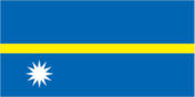
description: a blue field features a slim horizontal gold band at its center, with a prominent white 12-pointed star positioned below the band on the left
meaning: the blue symbolizes the Pacific Ocean; the star represents the nation’s placement relative to the equator (denoted by the gold band), and the 12 points signify the original tribes of Nauru; the white color of the star signifies phosphate, which is foundational to the island's economic prosperity.
Capital
name
there is no designated capital; governmental activities are conducted in the Yaren District.
time difference
UTC+12 (17 hours ahead of Washington, DC, during Standard Time)
Suffrage
20 years of age; universal and compulsory
Constitution
history
effective 29 January 1968
amendment process
amendments are proposed by Parliament and require a two-thirds majority vote for passage; changes to constitutional articles, which include the republican system of governance, the safeguarding of fundamental rights and freedoms, and the organization and powers of the executive and legislative branches, also necessitate a two-thirds majority in a referendum.
Country name
former
Pleasant Island
etymology
the island's name may originate from the Nauruan term "anaoero," translating to "I go to the beach"; the previous name, Pleasant Island, was attributed to British navigator John Frean, who explored the area in 1798.
local long form
Republic of Nauru
local short form
Nauru
conventional long form
Republic of Nauru
conventional short form
Nauru
Independence
31 January 1968 (independence from the UN trusteeship administered by Australia, New Zealand, and the UK)
Legal system
a hybrid legal system that combines common law influenced by English law and customary law.
Government type
parliamentary republic
Judicial branch
highest court(s)
Supreme Court (consists of the chief justice and several justices)
subordinate courts
District Court, Family Court
judge selection and term of office
judges appointed by the president to serve until age 65
Executive branch
cabinet
Cabinet appointed by the president from among members of Parliament
chief of state
President David ADEANG (since 30 October 2023)
election results
2025: David ADEAGN was elected president (unopposed)
2023: David ADEAGN won the presidency against Delvin THOMA, with a vote count of 10-8.
head of government
President David ADEANG (since 30 October 2023)
most recent election date
14 October 2025
election/appointment process
president indirectly elected by Parliament for 3-year term (eligible for a second term)
expected date of next election
2028
National holiday
Independence Day, 31 January (1968)
National color(s)
blue, yellow, white
Political parties
Nauru lacks official political parties; governmental coalitions are frequently based on familial connections.
Legislative branch
term in office
3 years
number of seats
19 (all directly elected)
electoral system
plurality/majority
legislature name
Parliament
scope of elections
Full renewal
legislative structure
unicameral
most recent election date
10/11/2025
expected date of next election
October 2028
percentage of women in chamber
10.5%
National anthem(s)
title
"Nauru Bwiema" (Nauru, Our Homeland)
history
adopted 1968
lyrics/music
Margaret HENDRIE/Laurence Henry HICKS
National symbol(s)
frigatebird, calophyllum flower
Administrative divisions
14 districts; Aiwo, Anabar, Anetan, Anibare, Baitsi, Boe, Buada, Denigomodu, Ewa, Ijuw, Meneng, Nibok, Uaboe, Yaren.
Diplomatic representation in the US
FAX
[1] (212) 937-0079
chancery
801 2nd Avenue, Third Floor, New York, NY 10017
telephone
[1] (212) 937-0074
chief of mission
Ambassador Lara Erab DANIEL (since 13 January 2025); note - also serves as Permanent Representative to the UN.
email address and website
[email protected]
https://www.un.int/nauru/
Diplomatic representation from the US
embassy
the US does not maintain an embassy in Nauru; the US Ambassador to Fiji is also accredited to Nauru.
International organization participation
ACP, ADB, AOSIS, C, FAO, G-77, ICAO, ICCt, IFAD, Interpol, IOC, IOM, ITU, OPCW, PIF, Sparteca, SPC, UN, UNCTAD, UNESCO, UPU, WHO, WMO
International law organization participation
has not presented a declaration of ICJ jurisdiction; acknowledges the jurisdiction of the ICCt.
Economy
Budget
revenues
$199.74 million (2020 est.)
expenditures
$157.86 million (2020 est.)
Exports
Exports 2021
$54.403 million (2021 est.)
Exports 2022
$78.383 million (2022 est.)
Exports 2023
$64.931 million (2023 est.)
Imports
Imports 2021
$141.185 million (2021 est.)
Imports 2022
$165.371 million (2022 est.)
Imports 2023
$150.193 million (2023 est.)
Industries
phosphate extraction, offshore financial services, coconut-based products
Public debt
Public debt 2016
65% of GDP (2016 est.)
Remittances
Remittances 2021
0.7% of GDP (2021 est.)
Remittances 2022
0.6% of GDP (2022 est.)
Remittances 2023
0.6% of GDP (2023 est.)
Exchange rates
Currency
Australian dollars (AUD) per US dollar -
Exchange rates 2020
1.453 (2020 est.)
Exchange rates 2021
1.331 (2021 est.)
Exchange rates 2022
1.442 (2022 est.)
Exchange rates 2023
1.505 (2023 est.)
Exchange rates 2024
1.515 (2024 est.)
Economic overview
upper-middle-income island nation in the Pacific; depletion of phosphate resources rendered the inland areas uninhabitable; licenses fishing rights; hosts Australia's Regional Processing Centre; previously a tax haven; heavily reliant on foreign aid
Exports - partners
Thailand 78%, Philippines 11%, NZ 5%, Japan 1%, Canada 1% (2023)
Imports - partners
Australia 50%, Japan 11%, Fiji 9%, Senegal 9%, China 9% (2023)
Real GDP per capita
Real GDP per capita 2022
$12,500 (2022 est.)
Real GDP per capita 2023
$12,500 (2023 est.)
Real GDP per capita 2024
$12,600 (2024 est.)
Real GDP growth rate
Real GDP growth rate 2022
3% (2022 est.)
Real GDP growth rate 2023
0.6% (2023 est.)
Real GDP growth rate 2024
1.8% (2024 est.)
Agricultural products
coconuts, tropical fruits, pork, eggs, pork offal, pork fat, chicken, papayas, vegetables, cabbages (2023)
Exports - commodities
fish, phosphates (2023)
Imports - commodities
ships, titanium ore, refined petroleum, plastic goods, other food items (2023)
Current account balance
Current account balance 2021
$6.597 million (2021 est.)
Current account balance 2022
$2.966 million (2022 est.)
Current account balance 2023
$1.923 million (2023 est.)
Taxes and other revenues
44.4% (of GDP) (2020 est.)
GDP (official exchange rate)
$160.351 million (2024 est.)
Inflation rate (consumer prices)
Inflation rate (consumer prices) 2020
1.8% (2020 est.)
Inflation rate (consumer prices) 2021
2.4% (2021 est.)
Inflation rate (consumer prices) 2022
2.6% (2022 est.)
Real GDP (purchasing power parity)
Real GDP (purchasing power parity) 2022
$147.026 million (2022 est.)
Real GDP (purchasing power parity) 2023
$147.976 million (2023 est.)
Real GDP (purchasing power parity) 2024
$150.581 million (2024 est.)
Energy
Petroleum
refined petroleum consumption
500 bbl/day (2023 est.)
Electricity
consumption
37.893 million kWh (2023 est.)
installed generating capacity
19,000 kW (2023 est.)
transmission/distribution losses
3.922 million kWh (2023 est.)
Electricity access
electrification - total population
100% (2022 est.)
Electricity generation sources
solar
12% of total installed capacity (2023 est.)
fossil fuels
88% of total installed capacity (2023 est.)
Communications
Internet users
percent of population
82% (2020 est.)
Broadcast media
One government-owned television channel airs content from New Zealand; one state-operated radio station, transmitting on both AM and FM frequencies, features Australian and British programming (2019)
Internet country code
.nr
Telephones - fixed lines
total subscriptions
0 (2019 est.) 0
subscriptions per 100 inhabitants
(2022 est.) less than 1
Telephones - mobile cellular
total subscriptions
10,300 (2022 est.)
subscriptions per 100 inhabitants
87 (2022 est.)
Broadband - fixed subscriptions
total
1,000 (2022 est.)
subscriptions per 100 inhabitants
10 (2022 est.)
Transportation
Ports
large
0
small
0
medium
0
key ports
Nauru
very small
1
total ports
1 (2024)
ports with oil terminals
1
Airports
1 (2025)
Merchant marine
total
6 (2023)
by type
other 6
Civil aircraft registration country code prefix
C2
Military & Security
Military - note
According to a security agreement finalized in December 2024, Australia and Nauru committed to "enhance and broaden security collaboration" and to "discuss and evaluate" in response to potential threats; Nauru committed to obtaining Australia’s consent prior to entering into any bilateral agreements concerning maritime security, defense, and law enforcement, and would be granted Australian financial support to aid in meeting Nauru's policing and security requirements.
Nauru maintains a "shiprider" arrangement with the United States, permitting local maritime law enforcement agents to join US Coast Guard (USCG) and US Navy (USN) vessels, which includes the authority to board and inspect ships suspected of breaching laws or regulations within Nauru’s designated exclusive economic zone (EEZ) or in international waters; such "shiprider" arrangements also allow for USCG personnel and USN ships that carry USCG law enforcement officers to collaborate with host nations to safeguard vital regional resources (2025)
Military and security forces
no standing military forces; Nauru Police Force
Transnational Issues
Refugees and internally displaced persons
refugees
95 (2024 est.)